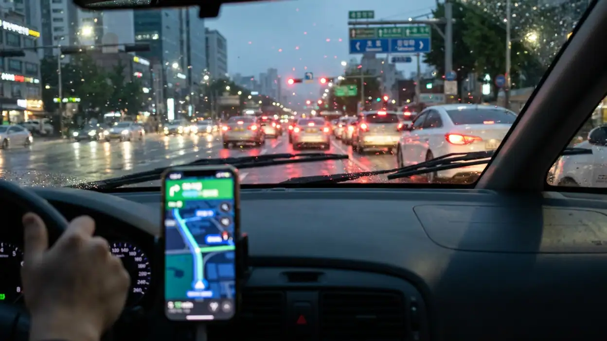
 Article about Waze Navigation & Live Traffic
Why Waze Navigation and Live Traffic Still Depends on Its Drivers
AppCompare
A navigation app usually feels like a finished product: enter a destination, follow the line, arrive. Waze is more interesting, and more fragile, because its best information is not finished at all. It is being produced by drivers in motion. A stalled car, a sudden queue, a police presence, a flooded road, a cheap fuel stop, or a closure can change the route for everyone behind it. That makes Waze Navigation & Live Traffic less like a digital atlas and more like a live public utility assembled by people who may never meet.
I spent time using Waze as both a driver and a reader of other drivers' judgments. The turn-by-turn guidance is familiar territory now, but the community layer remains the reason to choose it over a quieter, more conventional map. Waze earns its place when local knowledge moves faster than official data. It becomes less convincing when reports are stale, vague, duplicated, or shaped by the impatience of strangers. My central conclusion is simple: Waze is at its strongest not because it knows every road, but because it gives ordinary drivers a practical way to correct the map while the journey is still happening.

Waze Navigation & Live Traffic
Waze · 4.4 · Free · Android, iOS
The community is the feature
The first thing to understand about Waze is that its community is not a discussion forum attached to a navigation app. It is embedded in the driving task. Most users do not open Waze to socialize, collect badges, or study a map. They open it because they need to get somewhere. Community participation happens in short bursts, often with one tap or a voice command, and its reward is immediate: a warning appears for the next driver, a route adjusts, and a small piece of uncertainty disappears.
That creates a distinctive social contract. You contribute because another driver may have helped you five minutes earlier. The exchange is mostly anonymous and asynchronous. There is no expectation of conversation, yet the road feels populated by a loose network of observers. A report from a driver ahead can feel oddly personal even though it is not addressed to you. It says, in effect, someone saw the problem and thought it was worth passing along.
This is also why Waze can feel more alive than standard navigation. Traffic colors shift, incidents appear, and route estimates respond to conditions that may not yet be visible from your windscreen. The map is not merely representing the road. It is representing what the driving community currently believes about the road.
A low-effort participation model
Waze keeps contribution deliberately lightweight. During navigation, the reporting controls are designed around recognizable events: a crash, hazard, slowdown, roadwork, blocked lane, stopped vehicle, or other disruption. The best reports take seconds. That matters because every extra field, confirmation screen, or demand for explanation would discourage participation at exactly the moment information is most valuable.
The model works because the contribution threshold is low and the audience is large. A driver does not need to write a detailed account or prove expertise. They need to notice something and choose the closest category. In principle, this gives Waze a constant stream of observations from people distributed across the road network rather than a small editorial team sitting behind a desk.
There is a trade-off. A low barrier also lets in low-quality information. A report may be accurate but poorly timed, technically correct but no longer relevant, or simply the result of a hurried tap. Waze can aggregate signals, but it cannot turn every observation into certainty. The community model is powerful precisely because it accepts imperfection; users have to accept that the map is a set of live estimates, not a court record.
That distinction changes how I read the interface. A warning is useful, but it is not a command. A red section of road suggests a problem, not its exact cause. An icon can tell me that another driver saw a hazard without telling me whether the hazard is still there. Waze's design encourages quick interpretation, but good use still requires judgment.
How newcomers enter the network
New users do not need to understand the social system before benefiting from it. The easiest entry point is passive: install the app, set a destination, and watch the route respond to traffic. The community reveals itself through alerts and changing estimates before the newcomer ever submits a report. This is a sensible onboarding pattern because it demonstrates the network's value before asking for labor.
Participation usually begins with a moment of recognition. You pass a broken-down vehicle, notice a lane closure, or crawl through a queue that is not reflected accurately. The report button turns private frustration into a public correction. The action is small enough to repeat, and the next time an alert saves you from a surprise, the exchange becomes more tangible.
Waze also makes contribution feel less formal than editing a conventional map. You are not claiming ownership of a road database. You are adding a temporary observation to a shared journey. That distinction lowers the psychological cost. A newcomer can contribute without feeling like a cartographer, moderator, or local authority.
Still, the first experience can be noisy. New users may see many alerts without knowing which deserve trust, especially in busy cities where icons accumulate quickly. The app assumes a degree of road literacy: users must distinguish a current obstruction from an old one, a broad congestion pattern from a single incident, and a useful detour from a route that merely looks shorter. Waze teaches through repetition rather than through a long tutorial, which suits experienced drivers but leaves some newcomers to learn by trial and error.
The rituals that keep the map breathing
Waze's recurring rituals are brief and practical. Drivers check the proposed route before leaving, glance at the estimated arrival time, listen for spoken instructions, and occasionally report what they see. During a commute, the ritual may be almost unconscious. Open the app, accept the route, confirm the first turns, and let the live layer do its work.
There is another ritual after a report: watching whether the map reacts. If traffic suddenly builds, the user may wonder whether an earlier warning was accurate. If a closure clears, the route may normalize. This feedback is not always explicit, but it reinforces the sense that the network is changing in response to real conditions.
Longer-term users may also engage with the map beyond a single trip. Some review road details, correct places, or contribute local knowledge through the broader editing ecosystem. These activities are more deliberate than tapping a hazard report and require greater confidence. I would not treat every user as part of that deeper layer, and the exact availability or workflow can vary by region and account status. The important point is that Waze has both a passing-observer community and a more committed group willing to maintain the underlying map.
That layered participation resembles a town with different kinds of residents. Most people pass through and point out immediate problems. A smaller number learn the streets, notice structural errors, and invest time in repairs. The network needs both groups. Without casual reports, it loses immediacy. Without sustained maintenance, it risks accumulating errors that short-lived alerts cannot fix.
What creators and contributors actually add
In Waze, the word creator is less obvious than it is in a social network or a game. There are no conventional posts to publish and no creator economy at the center of the product. The meaningful creators are the people who generate, refine, and sustain useful road information: everyday drivers, local map editors, community organizers, and contributors who understand how a particular area behaves.
Their work appears in different time scales. A driver reports a fallen branch, creating information that may matter for minutes or hours. Another contributor helps correct a street name or road connection, producing value that can persist much longer. A local expert may understand recurring event traffic, seasonal closures, or a confusing junction that outsiders repeatedly mishandle. Each contribution turns personal familiarity into shared infrastructure.
This is where Waze differs from a purely algorithmic navigation service. Algorithms can infer congestion from movement data, but they are less naturally equipped to explain why traffic is stopped or whether a hazard sits in a particular lane. Human reports add context. They can also introduce bias, inconsistency, and misunderstanding. The value is not that humans are always right; it is that human observation covers details that automated sensing may miss.
The strongest contributions are specific, timely, and easy to act on. “Road blocked ahead” is useful because it changes behavior. A vague complaint about traffic is less valuable because it confirms what the map may already show without explaining the cause. Waze's community succeeds when contributors translate observation into a decision another driver can make.
The social friction of reporting from a moving car
The uncomfortable truth is that Waze's community depends on attention at the exact moment attention should remain on driving. The app tries to reduce this conflict with simple controls and voice features, but no interface can remove the underlying risk. A driver who is eager to report every detail may become a distracted reporter. A driver who ignores the app entirely may miss a useful warning. The healthiest participation model is selective: report only when it is safe, and do not treat community contribution as an obligation.
There is also friction between individual speed and collective accuracy. A user may want the fastest route immediately, while the network benefits from careful reports that improve future decisions. Rerouting can send traffic onto smaller roads, creating relief on one corridor and inconvenience on another. Waze is not simply helping each driver independently; it is distributing movement through a shared road system.
That distribution can feel clever when it avoids a jam and irritating when it sends unfamiliar traffic through residential streets. The app's route logic is not a neutral observer. It makes choices about which roads should absorb demand. Users may appreciate the time saved while residents experience the side effects. This tension is not unique to Waze, but the app's live, community-driven character makes it especially visible.
There is social friction inside the reporting layer as well. Multiple drivers may report the same event. Some may disagree about the severity of a hazard. Others may submit a report after the situation has already changed. The interface has to compress these messy human observations into clean icons and prompts. That compression is convenient, but it can hide disagreement and uncertainty.
Moderation, trust, and what remains unclear
Waze clearly needs moderation, whether through automated systems, user feedback, internal review, community editing rules, or a combination of those methods. Reports must be checked, aged out, merged, or removed. Map edits need standards. Malicious or careless contributions need limits. Yet from the driver's seat, the exact boundaries of this system are not always visible.
That lack of visibility is not necessarily a flaw in the driving interface. Most people do not want a moderation dashboard while navigating. Still, it creates an important trust question: how does Waze decide which community signals deserve prominence? Users can often confirm or dismiss reports, but they are not given a full explanation of the underlying confidence model. I can judge whether an alert looks plausible; I cannot always know why it appeared or why another report did not.
Safety adds another layer. Some reports involve police activity, crashes, or vulnerable people on the roadside. The usefulness of sharing information must be balanced against the possibility of encouraging risky behavior, harassment, or attempts to evade enforcement. I would be cautious about making broad claims about how every category is moderated in every region, because policies, features, and enforcement can change. What is clear from the product's role is that community reporting cannot be treated as harmless decoration. It affects real decisions in real traffic.
Waze also has to manage privacy expectations. The service relies on location and movement data to provide navigation and traffic intelligence, while community features make road activity feel public at the moment it is reported. Users should understand that convenience comes with data considerations, and they should review current permissions and privacy settings rather than assuming the default arrangement fits them.
For me, the right attitude is calibrated trust. I trust a cluster of consistent signals more than one isolated icon. I trust a report that matches what I can see more than one that contradicts the road. I treat the app as an informed companion, not an authority that removes responsibility from the driver.
Where the network value becomes unmistakable
The network earns its keep in situations where official information lags behind reality. A major crash can turn a familiar route into a parking lot before a formal traffic notice is updated. A temporary closure may be known to local drivers long before it appears in a static database. A sudden hazard can matter for the next ten minutes even though it has no permanent place on the map.
Waze is especially persuasive in dense urban areas, during rush hour, around large events, and on routes with frequent disruptions. In those environments, the difference between a merely accurate map and a responsive one is substantial. The app can show not only where roads are, but how the driving community is experiencing them right now.
It is also valuable for visitors who lack local instincts. A resident may know that a certain junction backs up after a football match or that a particular lane disappears without warning. A newcomer does not. Community data can partially substitute for that local memory, although it cannot guarantee that every local pattern has been captured.
Outside busy areas, the advantage is less consistent. Sparse reporting means fewer observations, and a quiet map may reflect limited participation rather than trouble-free roads. This is one of Waze's central inequalities: network value grows where users are already concentrated. The app can be excellent on a crowded commute and merely adequate on an isolated rural journey.
The comparison with traditional map apps clarifies the choice. A service such as Google Maps may feel broader and more encyclopedic, with strong place information and familiar mapping tools. Waze's distinctive value is narrower but deeper: it wants to tell me what may interfere with the drive itself. The competition is not about which app contains more information in total. It is about whether I need a stable map of the world or a live account of the road.
Can the ecosystem last?
Waze's ecosystem can last as long as its exchange remains visibly worthwhile. Users must believe that reports improve their own trips, not merely help an abstract platform. The app benefits from a virtuous cycle: more drivers create more observations, better observations make the service more useful, and usefulness attracts more drivers.
But network effects can weaken. If reporting becomes annoying, if alerts become unreliable, if routing repeatedly creates neighborhood problems, or if users feel their data is being collected without a clear return, participation may decline. A community product does not survive on scale alone. It survives on perceived fairness and repeated evidence that contribution leads to better outcomes.
There is also a generational challenge in the interface. The app must remain simple enough for a first-time user while serving contributors who want greater control and accuracy. Too much complexity makes casual participation unsafe or unattractive. Too little structure allows noise to overwhelm useful signals. Maintaining that balance is a permanent design problem, not a one-time feature release.
Waze's future may also depend on how it handles automation. Better sensors, connected vehicles, and predictive traffic models could reduce the need for some manual reports. That would be good if automation removes repetitive work without erasing human context. The most durable version of Waze is probably not human reports versus algorithms, but human observation interpreted alongside machine-detected patterns.
What I would watch most closely is whether the company preserves the feeling that contributors matter. If the community becomes invisible labor feeding a black box, participation may feel less reciprocal. If the app shows that reports are timely, useful, and responsibly handled, the social contract remains credible.
The community verdict
Waze is not best understood as a map with extra buttons. It is a coordination system for drivers who share partial knowledge under pressure. Its rituals are small, its contributors are mostly ordinary people, and its rewards arrive as fewer surprises rather than as social recognition. That modesty is part of its strength. The app does not ask users to build a public identity; it asks them to notice the road and pass along what matters.
The ecosystem is most convincing when it transforms scattered observations into a timely decision: leave earlier, take another route, expect a blocked lane, or slow down for a hazard. It is less convincing when the map becomes crowded with stale alerts, when rerouting shifts problems onto local streets, or when users mistake community reports for guaranteed truth. Those weaknesses are not side notes. They are the cost of building navigation from live participation.
After testing it, I would choose Waze for complicated commutes, unfamiliar city driving, event traffic, and any journey where current road conditions matter more than a polished directory of places. I would still keep my judgment switched on, and I would never report while doing something that compromises safe driving. The app's real achievement is not that it predicts every delay. It is that it turns drivers into a distributed sensing network without making contribution feel like a second job.
Waze Navigation & Live Traffic remains compelling because its map is never entirely finished. Every useful report is a tiny act of cooperation, and every inaccurate one tests the limits of trust. That makes Waze unusually human for a navigation tool: fast, practical, occasionally messy, and at its best when thousands of strangers quietly help one another get through the same road.